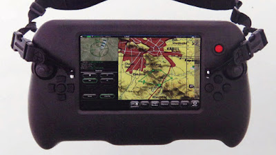
Lockheed Martin has released a commercial software, named Hydra Fusion Tools, that allows to create a real-world 3D Map of any site. Hydra Fusion runs on commercial computers leveraging state-of-the-art graphical processing units, to render the entire evolving scene in real time, as the UAV flies: The images are geometrically stitched together into an immersive three dimensional world view, showcasing buildings, trees, vehicles, terrain, etc.
“Hydra Fusion Tools’ stand-out feature is its ability to turn big data into actionable intelligence,” says John Molberg, business development manager at Lockheed Martin CDL Systems. “This is true world-leading technology – there is nothing else out there that does this, everything else is just post-processing.”
The system comes in two variants: the baseline Hydra for commercial use, with agriculture and first responder application, and Hydra Tactical, which is specifically for military use.

